How to correct Scanline Error/Banding in Landsat 7 images
If you want to correct for banding in Landsat 7 images, the USGS has a system for correcting Landsat 7 satellite images. Although there are several methods based on interpolation, you can resort to a simple tool with the help of the Landsat Toolbox for ArcGIS.
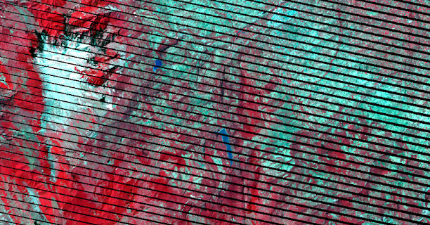
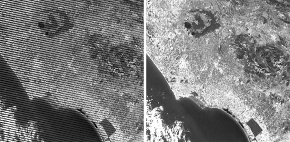
If Landsat 7 images are recognizable for something, it is because of their satellite image banding problems, generating gaps or lines of absence of information with a slight inclination towards the sides while the central area is displayed correctly. An error that generates missing data by displaying the image through banding of stripes or lines parallel to each other. Something that, even though it is typical of Landsat 7, also occurs in some images from other space missions due to radiometric errors and that can be corrected in a similar way.
Landsat Toolbox developed by the Washington State Department of Transportation (WSDOT).
You can download the Landsat Toolbox for Landsat 7 image correction from here . You can incorporate the tool into ArcGIS Pro or ArcMap by right-clicking on ArcToolBox and selecting the Add Toolbox option from where you should search for the TBX file.

Once you have loaded the tool, you can execute the Fix Landsat 7 Scanline Errors option, incorporating the band to be corrected and assigning a name and output route to save the corrected band. Give time to processing, it will take a few minutes to process the data.

Comments
Post a Comment